Geophysical survey is often stipulated by local authority archaeologists as an integral part of archaeological site investigations in planning conditions. But what is geophysical survey and why use it?
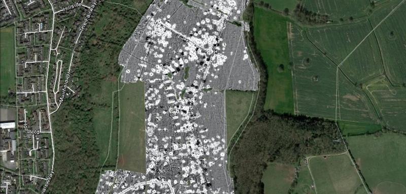
Geophysical survey, also known as geophysics, describes a range of techniques that reveal and map archaeological features that are not easily recognisable on the ground by measuring the earth’s physical characteristics. Buried archaeological remains cause subtle variations or ‘anomalies’ in properties such as soil magnetism and electrical conductivity.
It’s a relatively cheap way of determining how much and what kind of archaeology is present without digging any big holes. Knowing this early on helps us plan further archaeological work, target trial trenches where concentrations of activity archaeology are identified (we call this ‘evaluation’) and get an indication of costs and timescales for the archaeology required. Geophysical survey plots also help us to interpret trial trench results by indicating how different archaeological features, like ditches or walls, are likely to link up in the unexcavated areas in between.
The techy bit
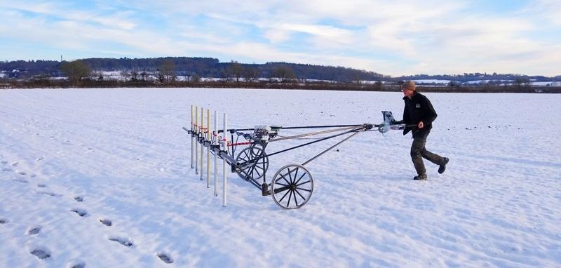
Magnetic surveys are the most common, on account of their reliability and speed. A bank of sensors is mounted on a lightweight handcart, with an on-board GPS antenna logging the survey route to centimetre accuracy. Operated by a two-person team, a cart can cover over five hectares in a day, in the right conditions.
How does it work? Soil itself is magnetic thanks to the presence of magnetite and other iron-bearing minerals, and differences between deposits can be picked up by a high-precision sensor. So, a pocket of strongly magnetic soil within a backfilled henge monument will contrast with the weaker magnetism of its surroundings; and the fired clay structure of a Roman kiln will contrast stronger still.
The sensor is hyper-sensitive (measurements equivalent to one half-millionth of overall geomagnetic field) which is great for detecting magnetite but has its downsides too. Bedrock and groundwater can create ‘background noise’, and metal fences, buried pipes, and even passing traffic can produce magnetic anomalies strong enough to swamp archaeological readings. For this reason, it is best suited to green-field sites (farmland, parks, etc.) with fewer sources of magnetic interference.
The other commonly used technique is earth resistance survey, which measures how easily an electrical current passes through the ground. Often used to complement magnetic survey data, resistance survey is slower, covering perhaps 0.5 hectares in a day. It is brilliant at detecting buried wall foundations and can even be used to reveal historic garden layouts, right down to the paths and individual flowerbeds.
Lastly, there is ground penetrating radar (GPR), which is the most technically complex technique. It works by transmitting electromagnetic pulses into the ground and measuring the time taken for reflections of each pulse to return to a receiver. These reflections arise when the pulse hits a solid object, like wall foundations, floor surfaces and pipes. The time taken for each reflection to return shows the relative depth of the archaeological feature in questions and by collecting a large number of readings it is possible to build up 3D plans of buried remains.
Geophysics is a great way of looking for buried archaeological features without breaking ground, but having someone able to interpret the results is crucial. Thankfully our geophysics team are prepped and ready, so let us know if you get in a geophysical fix.

